Alder Street Station "For all sad words of tongue or pen / The saddest are these: It might have been!" -John Greenleaf WhittierLess prosaic, but more tantalizing: It almost was.
 In the long run, Ben Holladay was right; grass would grow on Front street. At the time of his infamous quip, delivered as he touted his plans for East Portland, it seemed unlikely. Lined by grand iron fronted merchant houses, such as Starr, Allan and Lewis and most importantly, the Oregon Steam Navigation Company, Front street drew commerce directly from the river and pushed it into the heart of the city. Its enterprises were at the root of the Portland establishment's fortunes.
 In the century that followed, Front would morph from street, to avenue, to parkway and witness the rise and fall of the Harbor Drive freeway and the birth of Tom McCall Waterfront Park. Prior to both, a very different waterfront nearly came into being.
  By the second decade of the the twentieth century Portland had turned its back on the river. Behind the impressive facades, the warehouses and wharfs of the old city had become a decrepit, disused warren as the harbor moved down stream. In 1919 the City Council called for a massive reworking of the waterfront. The resulting plan, by City Engineer Olaf Laurgaard, was released in 1923.
  The Report of City Engineer, Pursuant to Resolution No. 11130, With Plans and Estimates For Water Front Project , March 29 1923 was an ambitious recasting of the riverfront that sought to address multiple municipal ills. For flood control and fire abatement, the old docks were to be removed and a sea wall installed from Jefferson to Glisan streets, back-filled by material dredged from the Willamette. Behind the wall a new interceptor sewer would serve downtown. The area from the Hawthorne to Morrison bridges was set aside for a public market. Between the Morrison and Steel bridges a new wholesale district of large, modern warehouses would be built, accessed by trucks from the west and rail from the east.
 The proposed public market at the foot of the Hawthorne Bridge.
-Multnomah County Library (non-circulating collection). Photo courtesy of Alexander Craghead.
The report's transportation amenities balanced auto, rail and pedestrian modes. Bridge approaches were to be raised. Madison, Morrison, Burnside, Glisan and Front widened. Thousands of parking spaces were to be provided to alleviate downtown congestion. On top of the sea wall, a twenty five foot wide esplanade would "create a very pleasing recreational walk for the citizens of the city." Chief among the proposal was a consolidated terminal for the region's interurban electric rail lines and ocean going travelers to be located on First and Alder, with a breezeway over Front to the river.
Alder Street Station. (click on images to expand). -Multnomah County Library (non circulating desk). Photo courtesy of Alexander Craghead. Portland was served by three interurban lines: The Portland Railway Light and Power Company and its affiliates ran to Troutdale, Estacada, Oregon City, Mount Angel and over the Interstate Bridge to Vancouver Washington. The Oregon Electric Railway served Woodburn, Salem, Eugene, Albany and Forest Grove. Southern Pacific's "Red Electrics" connected Portland to Lake Oswego, Hillsboro, Newburg, McMinnville and Corvallis. The new terminal would provide a single boarding point for all three networks and remove the trains from downtown streets.
"At the present time a great deal of time is lost by these interurban lines crossing the business district of the City. As much time is consumed in traversing the business district as is consumed in traveling 15 or 20 miles after the City limits have been reached."
-The Report of City Engineer, Pursuant to Resolution No. 11130, With Plans and Estimates For Water Front Project The "Red Electric" steel cars boarded at Union Station, while the Oregon Electric operated from North Bank Station in what is now the Pearl District and from a station near the west end of the Hawthorne Bridge. The PRL&P Lines loaded at First and Washington.
 At river's edge the terminal would also serve ocean bound traffic such as from the Pacific Steamship Company, aka the Admiral Line.
-Images courtesy of Timetable Images , Bjorn Larsson. The plan called for the Red Electrics and the Oregon Electric to share the latter's tracks out of town to a point near Burlingame. The vacated Red Electric right of way would then be used as a new route for the Pacific Highway into Portland.The placement of the terminal, market, esplanade and parking facilities was anticipated to generate large amounts of pedestrian traffic that would revitalize the lower downtown district as people crossed back and forth to the city center. But the components of the plan were never to fully coalesce. It is tempting to view the Laurgaard plan as another instance of Portland dreaming big and spending small, alongside the Olmstead parks plan, Bennet's city beautiful re-design, the initial response to the Robert Moses report and the stadium proposals of the 1960s. Much of the plan though was implemented in relatively a short time. Work on the sea wall, interceptor sewer and esplanade, Oregon's largest public works project to that date, was completed in less than four years. Bridge access improvements, street widening and a public market were finished within a decade.
 The proposed sewer was hardly a panacea. Back ups into downtown basements ended as hundreds of makeshift outlets into the river were replaced- by a single overflow.
-City of Portland Archives. The Public Market building opened in 1933 on the site proposed by the Laurgaard Plan. Initially a success, its popularity with customers and vendors soon dropped off. It closed in 1942. From 1948 to 1961 it was home to the Oregon Journal. The building was demolished in 1968.
-City of Portland Archives. A street level view of the Portland Public Market and the smaller Sea Wall Public Market at Taylor and Front Avenue, prior to 1943. The railroad tracks were freight only, operated by the United Railway, an Oregon Electric Railway affiliate.Only the interurban / ocean terminal and the wholesale district proposals were not acted upon at all. With each recasting of the plan through the 1920s the rail component shrank as the popularity of the automobile grew. By 1930 it was gone. In 1933 the Pacific Highway would be built on the former Red Electric right of way as Barbur Blvd. In the early 1940s the waterfront would be used for transportation, in the form of the Harbor Drive freeway.
 Portland takes on a Le Corbusier tinge with the 1932 Bartholomew Plan. Intermediate between rail and freeway, it featured a park along the river.What if the report had been fully implemented? Any counterfactualist historic revelry has to be tempered by trends already in place at the time. As attractive as a regional electric rail network emanating from downtown would be today, Alder Street Station was unlikely to have arrested the decline of the interurban systems in the 1920s and 1930s.
Perhaps the city envisioned in the Laurgaard plan is best viewed along the lines of the many Portland's dreamed in Ursula LeGuin's The Lathe of Heaven, familiar elements recast to form alternate realities -made all the more intriguing by how close it actually came to pass. The proposed waterfront of 1923, a fold out in the report.
-Multnomah County Library (non-circulating collection). Photo courtesy of Alexander Craghead.
The Portland Railway Light and Power (later the Portland Railroad and Terminal Division of Portland Traction) lines continued to load at First and Washington for another thirty three years, until its tracks were removed from the Hawthorne Bridge, cutting access to downtown. The rare view above was possible only between 1954, when the Dekum Block (1871) was demolished to make a parking lot, and the end of downtown interurban service in September 1956.
The surface lot expanded upon the city's first, on the site of the Labbe Block, immediately next door. It is still there. 
Cyclorama!


It appears on the peripheral in photographs of Portland from the 1890s, a large circular building on the block bounded by Third, Fourth, Pine and Ash. A roundhouse perhaps, or a giant carousel? A Sanborn Insurance map from 1889 provides a name, Cyclorama, but not its function. Could it have been a velodrome? A Portland City Directory from the same year gives another hint:
The Cyclorama (Gettysburg) west side of 3rd, north of PIne.
Gettysburg; a clue leading to a entertainment phenomenon that transported audiences across space and time to distant vistas, surrounding them with a 360 degree view. Cyclorama: it was the IMAX theater of its day.
 The Robert R. Thompson mansion on Third street between PIne and Ash.A decade earlier, the upper end of Third street was home to a wealthy neighborhood of Portland's financial elite, anchored by the neighboring mansions of Oregon Steam Navigation magnates John C. Ainsworth and Robert R. Thompson that faced each other across Pine. A letter from Oregon pioneer Jesse Applegate, written from Yoncalla to Ainsworth on September 3rd 1869 hints at the genteel elegance of the district, just four years after the end of the Civil War:"In my morning walks through the city, I remarked on the good taste displayed in the selection and arrangement of the trees, shrubs and other ornaments, and their adaptation to mansion and grounds the were intended to beautify- and when I learned the place was yours I promised myself the pleasure of a closer inspection."
 The John C Ainsworth and Robert R Thompson (far right) mansions.
As downtown expanded inland, the enclave was pressured by commercial uses. The arrival of the grandly named Transcontinental Street Railway horse-car line in 1883 signaled its end as a bucolic retreat, as noted in the Portland City Directory of 1884:
"A most remarkable change in the present volume, as compared to its predecessors, is the removal of many families whose names are familiar in the history of Portland from the localities which, but a year or two ago, were reckoned to be the most aristocratic and desirable residences in Portland, North Third and Fourth streets, which were the sites of our most elegant residences, have been abandoned to business..."
As the well-to-do vacated Third, a new exclusive neighborhood of palatial homes emerged on the west side of the Couch Addition, centered on 19th street. Ainsworth and Thompson had departed the region entirely, opting for Oakland and San Francisco respectively. Not everyone left. Ben Holladay, former master of flash and finance, ruined in the crash of 1873, remained, stranded, in his Italian-villa styled house on the south west corner of Third and Stark until his death in 1887.
 Ben Holladay, exile on Third street.
By that time Third street was a very different place. Banks and business blocks were followed by hotels, restaurants and entertainment venues such as Cordray's Musee & Theatre which advertised opera, comedy and drama. Also slated for Third was the latest in entertainment extravagance; a cyclorama.
 The Boston Cyclorama.Cycloramas were a sort of nineteenth century virtual reality, which transfixed audiences with huge wrap-around 360 degree paintings, lighting, effects, narration and life-size diorama elements, transporting them to historic events, often battles. Gettysburg was a common subject (appearing at Gettysburg, Boston, Buffalo, Brooklyn, Chicago, Philadelphia, Denver and doubtless other locations). The Crucifixion of Christ (Buffalo), the Siege of Paris (Melbourne Australia), the Battle of Atlanta (Atlanta), the Battle of Sedan (Toronto), Waterloo (Melbourne again) and Jerusalem (Quebec) were among many topics portrayed.The Portland Cyclorama Company was established in 1887. The company's well established board members consisted of L.L. Hawkins, an Ainsworth banking partner, Harvey W. Scott, editor of the Oregonian, Rufus Mallory, a former U.S. Congressman, Geroge P. Frank, a future Portland mayor, Byron P. Cardwell, a member of the Board of Police Commissioners, C.W. Robey, a former postmaster and F.N. Shurtliff.
Midway through the year, construction began on a large three story brick building on the block bordered by Third, Fourth, Pine and Ash, on the grounds of Ainsworth's Oregon Steam Navigation associate Robert R. Thompson's mansion, which had been subdivided into rooms to rent.
 The Portland Cyclorama in the early 1890s, part of a warren of interconnected buildings that included the old R.R. Thompson mansion (three peaked windows facing south). Directly across Pine is the Ainsworth mansion (lower right hand corner) then leased to the Arlington Club.
 A portion of the existent Battle of Gettysburg cyclorama at Gettysburg Pennsylvania.
To anchor the spectacle, the popular Battle of Gettysburg cyclorama painting by French artist Paul Philoppoteaux, the original of which was debuted in Chicago in 1883, was chosen.
Portland's copy, weighing twelve thousand pounds, arrived December 7 1887, stood on end and by use of a thirty five foot high wheeled tower on tracks, slowly unrolled and hung. Two artists then arrived to add finishing touches such as clouds and smoke to the painting.

The Portland Cyclorama opened to wide acclaim, speeches by notables such as the Reverend Thomas Lamb Elliot and rave reviews on December 29 1887.

"The building in which it is exhibited is circular and the painting covers the entire circuit of the walls from top to bottom. Light is admitted from the roof and a canopy over the platform in the center where spectators stand, cuts the line of vision just below the top of the painting.
The platform is reached by a subterranean passage and a winding stair case and when a person emerges on this platform it is precisely as if he had risen from under the ground in the center of the battlefield of Gettysburg, when the battle was at its height. Nothing is to be seen to show that one is inside a building, no wall, door, window or floor."
-The Morning Oregonian, December 30 1887.
To further the illusion, optical effects, real stone walls, wood fences and other features were blended out of the scene into the viewing area, where a narrator explained the unfolding battle at the moment of Pickett's Charge.
"With entire assurance it may be said that, of the great battle pictures on exhibition in various cities, none surpasses the "Gettysburg" now completed and thrown open to the public in Portland. Everyone who has seen this painting and the "Gettysburg" in Chicago pronounces the Portland picture greatly the superior one."
-The Morning Oregonian, December 30 1887.
 Hours were from Ten to Ten with a fifty cent charge of admission (25 cents for children).
It was a immediate region-wide success. Special showings, such as one for a group of 150 Vancouver area school children and a rail excursion from Salem were common. Letters to the editor poured in, asking for the proper pronunciation of cyclorama. A Gettysburg veteran, wounded in the battle, chose to be married there, the ceremony held in front of the place on the painting where he received his injury. Chief Joseph of the Nez Perce viewed it accompanied by an interpreter and a army general.

By the middle of 1891 the novelty had worn off and the need to revamp the spectacle was apparent. A live "battle" was added, acted in the foreground with cannon fire and muskets. At the finish of the narration the lights would dim and a lightning storm would commence, so real that some patrons were said to reach for there umbrellas. A military band closed the performances. The Oregonian noted that under such management, the Cyclorama would continue to draw for several years to come.
It was an optimistic assessment. On February 28 1892 admission was cut in half. The Oregonian noted that the rates would be for a short time only. Within five days it closed. The Portland Cyclorama had lasted four years and two months.
 The Cyclorama building (numbered #198) appears in this post 1893 drawing of downtown Portland.The building quickly re-opened as the Past Time Athletic Club, a 5,000 seat boxing arena ran by former welterweight champion Jack Dempsey "the Nonpareil" (not to be confused with the heavyweight champion of the same name). The Past Time was the scene of numerous bouts, including three that featured Portland's own Mysterious Billy Smith, on his way to claiming the welterweight championship of 1893.
 The Mysterious Billy Smith, Welterweight Champion of the World. Known as one of the dirtiest fighters ever, he was disqualified 13 times, a pro boxing record that holds to this day. He retired to Portland, for many years owning a bar named "The Champions Rest" until his death in 1937.
 The roof of the Cyclorama building can be seen, lower center in this picture, circa 1895. The cupola of the Pioneer Courthouse (post office) and the tower of the First Congregational, both still in existence can be seen, along with vanished Perkins Hotel, Hotel Portland, the Marquam on Morrison and the Oregonian's tower on Alder.
The building was reincarnated a second time in 1893 as the Alhambra Music Hall, based on the style of a London Music Hall, and a third time in 1894 as the Trocadero Theatre, a "high class vaudeville.
Blei's Trocadero, as it was also known, featured such national acts as the Mademoiselle Jaguarina, who specialized in knife and sword exercises, Zetta Tuforne, the operatic vocalist, Peppi Sternheim, "the Tyrolean Warbler", Miss Vera Gray, "refined song and dance specialties," Stuart "the male Patti," billed as America's greatest female impersonator, Gus Bruno, "one of the greatest American comedians," Billy Emerson, "the famous popular minstrel" and Sandow the Strongman, aka The Modern Hercules.
Based on San Francisco's Tivoli Theater, the opening performances would close with "the great burlesque of Monte Cristo."
 Stuart "the Male Patti"
 Sandow the Strongman (poster from the Trocadero in New York').
The Trocadero lasted but one extravagant year. After its close the building went into decline with a series of devolving uses, subdivided for retail space, or opened up for a dog show. In 1909 it was in use as a carpenters shop when the Thompson Estate stated the site would be the home of a new 2,500 seat theater. By the next year, the plans had changed and it was announced a $750,000 hotel would be built instead.
The Cyclorama, aka the Past Time Athletic Club, Alhambra Music Hall and the Trocadero was demolished in September 1910, to make way for the Multnomah Hotel, today known as the Embassy Suites.

"What and where was the Portland cyclorama?"
-Trivia question in the Oregonian, June 6 1927.
Its been awhile
since my last post. The usual summer frenzy was followed by a scare as our toddler had to have cataract surgery on his left eye. The months of check-ups, tests, second opinions and worry were not conducive to research and writing. The fine work of the Casey Eye Institute at OHSU has brought about a happy conclusion (!)
 A surprising relic at the Elk's Children's Eye Clinic at the Casey Eye Institute, a stained glass window commemorating the grand Elks Convention of 1912, from the original Elks building at 7th (Broadway) and Stark, which I wrote about in "A Summer Extravaganza."
 Be sure and check out Our Portland Story, a project that pairs essays by Portland writers about what they love about Portland with local designers to create a unique book that is great portrait of the city, just in time for the holidays. My essay, Old Portland, is on page 46. Available at Powells, numerous local stores and direct.
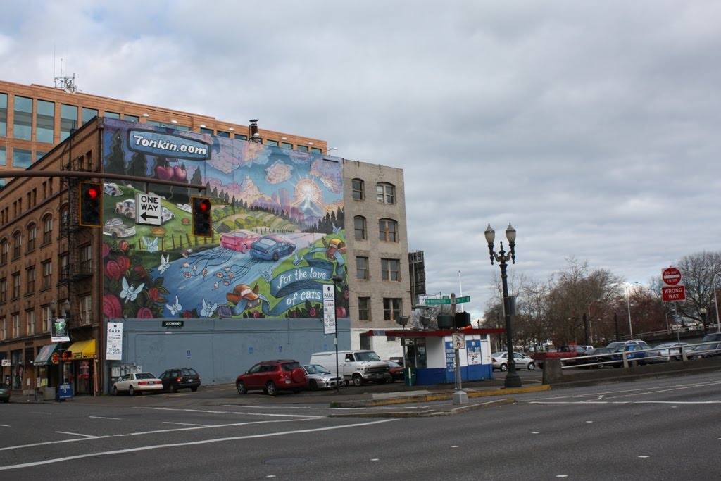
For the Love of CarsWe know how the story ends. Portland's first downtown, its iron-fronted steam punk version of an old European city, done in by apathy, bridge approaches, a freeway and most of all, surface parking lots. By the 1970s, less than thirty of the two hundred seventy cast iron buildings downtown remained. But how did it begin? When did Portland start to trade its most unique built feature for acres and acres of pay by the hour asphalt?
Portland 1968, the city that parks. The site of the original downtown, looking south. Note the former Public Market building, surrounded by the Harbor Drive freeway, in the left upper corner during the final stages of demolition. (click on images to expand) The same area, this time looking to the north, in 1935. The brand new Public Market building is to the right.Portland's ascendancy as "the Metropolis of the Pacific Northwest" was coincident with the rise of cast-iron as a building material for commercial structures. Viewed today as old fashioned, its manufacture allowed modular construction, modern in concept. Its vertical strength encouraged narrow supports permitting light filled spaces not previously possible. Local fabrication (for the most part) and the relative inexpensiveness of material allowed block upon block of ornate construction in a frontier city without the population to support the number of artisans required by traditional methods.
 Front Avenue, looking towards Ash in 1939, Minor White photograph. Everything on the right was torn down to make Harbor Drive in the early 1940s. The Smith Block (1872) on the left is one of the few cast iron survivors on Front (the southbound lanes of Naito Parkway). It houses Waterfront Bicycle Rentals.The era of cast-iron ended in 1889. Downtown shifted west, away from the river. The old "European section" would become known as the Wholesale or Commission District and was home to Chinatown, Japantown, a Gypsy community, second hand stores and Skid Road.
  Portland in 1935. The cast-iron fronted riverside downtown blended into to brick and sandstone of its 1890s successor, centered on 3rd, followed to the west by the gleaming terracotta city center of the early twentieth century. A close examination finds three surface parking lots.
 The December 4 1933 issue of the Oregonian announced the pending demolition of the Labbe Building on the north east corner of Second and Washington. Tenants were given thirty days to vacate the premises.
"The building as it stands affords some classic examples of the building art of the day. The entrance halls, stairways and elevator shaft display fine hand carved woodwork, but one of the most striking things remaining is the letter box rows on each side of the entrance hall. These letter boxes look like dove coats, each with its frosted glass door and slot above the mail to be dropped into the proper place." -The Morning Oregonian, December 4 1933.
Completed in 1880, the Labbe Building was the first four story commercial building in the city and the first with an elevator. It was designed by Warren H. Williams, whom a good portion of Portland's surviving cast-iron buildings are attributed to.
The Labbe brothers: Blaise, Antoine and John arrived from France in 1863. In 1865 they started a grocery business at Second and Washington. Fifteen years later constructed their commercial building across the street. It was regarded as the center of business and professional life as well as housing Morse's Palace, the city's most prominent art gallery. Pictures of the Labbe Building are hard to come by, but it appears to the far right with a red and white awning in a postcard from 1909. The next building on the right, across Second, is the Waldo Block, which still exists, (with modified upper windows) home to Mama Mia Trattoria.The Oregonian article was mum on what was to replace the building. In the areal photograph from 1935, the site is a surface parking lot, marked by fresh white paint on the neighboring wall. It has been one ever since.
 The lot at Second and Washington is in the center of the picture. By the time of the photograph (1935) it had been joined a block to the north by a second lot on the site of the Wienhard Building (1872) on Second and Oak.
 2nd and Washington, 2010.Just west of the old riverfront downtown, on Stark between Third and Fourth, was a third fresh surface parking lot in 1935, the site of the Chamber of Commerce Building.
 Built in 1893, the Chamber of Commerce Building was at the center of the new inland downtown developing on Third Street. Six stories high with a two story tower, it housed three banks on its first floor, a bowling alley, billiard rooms and a saloon. It featured an auditorium that was host to numerous political conventions and in 1905 was headquarters for the committee to organize the Lewis and Clark Exposition.
The lower floors of the building were submerged by the flood of 1894 and the top floors consumed by fire in 1906. Two additional stories were added in 1910, eliminating the tower. From Fourth and Stark, after the addition of two stories in 1910.Shortly after its completion the building was foreclosed upon during the financial crisis of 1894. It had numerous owners before being purchased by the Spokane, Portland and Seattle Railway, who's St Paul based owners decided to demolish it in 1933.
"We have made a thorough examination of the possible uses of the building and found that the cost of modernizing would be too great and that it would be better to tear it down and prepare the ground for possible development of that district in the future."
-Charles A. Hart, Attorney for the Spokane, Portland and Seattle Railway in the Oregonian. October 8 1933. Third and Stark, July 16 2010. Still waiting for that development.The demolition of the Portland Hotel in 1950 can be said to have been our Penn Station moment, when Portlanders began to realize the intrinsic value of what was being lost was greater than the short term gain brought by its replacement. An early voicing of the sentiment however can be found by reporter Don Giesy in the Oregonian, December 17 1933 writing about the Chamber of Commerce Building:
"The fact that the building is rich in history is of no consequence. That the building has tenanted a great many of our state leaders who have gained national prominence is of no import. Nor are we concerned with the almost human personality of the building. Were it standing in a European city, it would probably be used for 50 or 100 more years; but, to Impatient America, it is merely a symbol of a former era and is standing in the path of the juggernaut. Progress."
 The site of the Chamber of Commerce Building (center), a brand new lot in 1935. The newly revealed wall of the neighboring Sherlock Building finds use as a giant billboard for 7up.The demolition of the Chamber of Commerce Building went on into 1935. A surface parking lot immediately followed. By then a cycle was in place. As more businesses left the old downtown, the time lag toward a downward adjustment in property taxes added to the expense of keeping a vacant building. Demolition removed the buildings from the tax rolls. The rewards of surface parking lots, initially seen as a low cost stop gap before new development, soon became apparent. Three quarters of a century later the first lots are still in place, as are the vast majority of those that followed.
  Four years later, in 1939, the lot on the site of the Labbe Block (partially visible at center, far left) has gained neighbors.
 July 2010. Close examination of the billboard shows that it is likely painted on a wall from the Labbe building, still pressed against its neighbor. If so, it is a final remnant.
but just maybe there is another...
The Case of the Missing Weather VaneStewart Holbrook, Northwest literary giant, wrote in his Down Portland By-Paths column in the Oregonian on October 30 1934:"Folks who depended on the weather vane on top of the now demolished Labbe Building to tell them which way the wind lay are missing it. Most of them I judge, had no particular reason for wanting to know; just a habit.
It really was a swell vane. The spreadeagle which topped it was very lifelike. I discovered that when the building was torn down Antione Labbe* got the eagle and the vane. He tells me that after half a century the eagle, the arrow and the quadrant are all in excellent condition. He doesn't know whether or not it had been gilded since it was originally put in place, but the gold leaf is perfect.
The old eagle must have served as a mark for sharpshooters at some time or other, for there are several holes in the bird, obviously made by rifle bullets.
The eagle has a wingspread of 3 feet, the arrow is 4 feet long, and the entire vane stands 6 feet high. I asked Mr. Labbe what he was going to do with it. He said he thought he'd put it on top of his house. Wants to do something with it and that's probably where it will wind up, to tell Mr. Labbe and his neighbors how she blows. Until somebody puts another vane in the district where Labbe Building used to stand, there will be people, a lot of them, who will have to find something else to look at every day."So where is it?
A check with the city directory of 1934 gave me Antione Labbe's address. I went there and asked the current owner about it. There is no sign of the vane on the property. Did it perish in a war time scrap drive, or perhaps is buried in someones garage? Does it top another building to this day? If anyone knows, or if there are any descendants of the Labbe brothers who would like to talk with me about this, or another story that I am currently working on that pertains to the brothers, my email address is the letter d followed by my last name @comcast.net.*(the second Antione Labbe).
In A Summer Extravaganza (alternate title; The Glorious Results of Too Much Time on eBay) I asked where the following picture was taken:
 The answer: from an upper floor above Big Town Hero, on the corner of 11th and Morrison. Look closely, next to the middle stop light a small portion of the Baptist church tower that figures prominently in the 1911 picture nearly hidden by the building in front of it.

Now, lets go find that weather vane...