Wednesday, August 30, 2006

Hung Over on Burnside


They were called the Arcades: Those buildings on East Burnside with their upper floors above the sidewalk.

They date to a 1928-1929 street widening project which added two extra lanes to East Burnside, at the expense of the sidewalks.
When the sidewalks were re-installed, it was at the expense of bordering storefronts.
Of the original ten between Union (MLK Blvd.) and SE 11th, five remain.

A city ordinance in 1926 authorized the project. It soon ran into a controversy over how many buildings were to be “arcaded” and what compensation was to be given the owners. The issues were solved over the next two years and easements granted to the city “for the lifetime of the building(s)” in 1928.

In 1968 they were once again confronted by Burnside’s voracious appetite, as the Portland Chamber of Commerce proposed to widen the street into a six lane thoroughfare.
Nothing came of the idea.


Over the years they have housed a broad cross section of Portland life. Hotels, apartments, markets, taverns, strip joints, restaurants, coffee shops, saw sharpeners, phone rentals, music venues, auto shops, union halls, barber shops, plumbers, floor coverers, dance halls, shoe repairs, restaurant supplies, pagan supplies, clothing manufacturers, a candy factory, a bookstore, a hardware store, an oil burner distributor, Masonic halls and many others have called the buildings home.

A better illustration of Jane Jacob’s maxim that a city needs old buildings to incubate businesses can hardly be found. (Columbia Sportswear was housed in one of the buildings in the early 1960s).

The Arcades are an architectural vernacular unique to a single street. Albeit accidentally, they are incredibly well suited to Portland’s wet climate.


An Idea:


Amend Portland’s Building code to allow, even encourage, the construction of new “Arcades” on Burnside between MLK Blvd. and SE 11th.
Future Restaurants and bars could open out onto the covered sidewalks, blurring the boundary between indoors and outdoors. Space heaters would make outdoor dining possible for much of the year. The upper levels of the new buildings could be setback to allow patio space with full exposure to the sun and stars from above the walkways.

As new buildings gradually infilled between originals, commercial momentum generated by the new Burnside Bridgehead Development would continue east, with a unique streetscape from very local roots. If the Burnside / Couch couplet plan is adopted, the decrease in traffic would make the area even more attractive to street level activities.

Building on Burnside’s past, an “Arcade district” would expand upon the character of the old East Portland street, creating an area well adapted for year-round use.


A Tour of Portland Arcadia


The largest and most impressive was the first to go. The Burkhard Building was on the north side of Burnside between Union and Grand. It was built 1894, four years after the City of East Portland was merged along with Albina into Portland. The building housed a large dance hall and other businesses. In 1908 the upper floors were made into a Hotel, which was renamed the Arcade Hotel after the street widening. It was torn down in 1934. Today it is the site of Convention Auto Wholesale.
Photo is from the book “Progressive Portland-On the Move” courtesy of the author, Donald R. Nelson.


The Burkhard Building taken from the south side of Burnside, July 2nd 1931. The building to the left (now demolished) housed the New Arcade Apartments in the late 1920s-1930s.
Al Monner photograph, courtesy of Historic Photo Archive, http://www.historicphotoarchive.com/


The Kern Building (demolished), March 13th 1930, at the southwest corner of Burnside & Grand (the New Arcade Apartments on the southwest corner are visible on the next block). The building housed the Lloyd Hotel, Coleman Drug and the Palm Café. Note the original curb line still visible after the widening project.
Al Monner photograph courtesy of Historic Photo Archive, http://www.historicphotoarchive.com/


#612-616 E. Burnside was built in 1913. On the next block (at the trees) is the site of the Kern Building (previous picture).

The building is currently vacant. Recently it was an IWW Union Hall and the Back to Back Cafe.

The upper floors were known as the Mattsonian Apartments from 1921 to 1990 (when the name falls out of use in city directories).
#614 was a barbur shop for many years: Davie Norman's (1925-1942) then Chris & Davie's (1942-1950), C.E. Kingsley's (1950-1952), Al's (1952-1967), and Bill's (1967-1968), which was upgraded to Bill's Roffler Razor Styles (1968-1969). Brownies Barbur Shop (1970-1971) was the last. The space was used for storage from 1973 to 2003.

Walt's Cash Grocery was next door, at #616, from 1936 to 1949, followed by Fultz Market Groceries (1950-1952). Alex Groceteria (a word that seems to have vanished from the language) moved there in 1953 from #738 Burnside, (another arcaded building a block east). It was Ray's Groceteria from 1958 to 1971.

Between 1972 and 1978 it was the home of The Grape Estate, Wine and Beer Sales. From 1978 to 1988 It was the Boondox Tavern.


#722-737 E. Burnside is home to Hatties (vintage clothing), Another Moon (a pagan / new age store), Grendell's Coffee Shop and the Orleans Apartments.

It was built in 1909 by James H. Page. From 1909 to 1920 the apartments were called the Page Apartments. They were renamed the Alice Court Apartments in 1920,( that name appeared in city directories until 1988).
#727 (Grendell's Coffee Shop) was the location of a candy maker in the late 1920's. It was the Alice Court Restaurant 1935 to 1946 when the name changed to Alice Court Tavern. Things then took a nautical turn, the Port Hole Tavern (1959-1960) and the Pilot House Tavern (1961-1977). It was East Avenue Tavern and later Beglan's East Avenue from 1978 to 1997.

Grocery stores in the building included Dea's In and Out (1996), the Dai Chung Market (oriental food and gifts, 1982-1992), C.M, Henderson Grocery (1925-1926) and G.T. Eliopoulos Grocery (1923).

#723 (Hatties vintage clothing) housed Sprague Electric (formerly Electric House Supply) from the 1920's to 1943. In 1949 it was the location of Sav-A-Trip Shoe Service. Later occupants included Telemaster Company (television equipment, 1955), Photo-Tronics Camera & Electric Repair (1957-1958) Nielson Saw and Manufacturing (1961-1963), Carbide Saw Sharpening and Tool (1963-1965) and Mickelson & Edwards Magnetic Signs (1967-1968).
There was an Alice Court Barbur and Beauty at #733 in 1940.


#722-738 E. Burnside was built in 1907 as the East Side Masonic Temple. The upper floors remained as the Washington Masonic Lodge until 1994.

Many business have been on the street level, including Columbia Sportswear (1960-1962).

Saw sharpeners, a union hall, a chemical supply company, electric contractors, a frame shop and the American Indian Craft Center (1969-1970), were located there at one time.

Rent-A-Phone Plastic Products was in #754 from 1954 to 1957.

The location of the recent Colleen's Cafe (#738) has been a restaurant before: Earl's Lunch Room (1957-1963), Sherm and Vell's Cafe (1964-1968) and the Kerley Cafe (1968-1971). Earlier #738 was a drug store; Nichols Drug Company (1916-1946).

Grocery stores in the building included Max's Groceteria (1949), Collins Groceries and Joe's Meats (1950) and the Alex Grocetera (1951-1952, which moved a block west to #616 Burnside).

Currently the building is home to the Viscount Ballroom, Wax On Spa, Outlaws Bar and Grill and Wildcats.


Union Jack's has been at #938 E. Burnside since 1976.

The building was built in 1911. The upper floors housed the Klein Apartments, which lost their name in 1927. Downstairs, Jacob Krichevsky, Grocery (1923) was followed by East Burnside Grocery (1924-1932). Petrol Heat Company, (Oil Burners) made a brief appearence in 1933 followed by a vacancy that lasted two years.

The Paris Cafe, ran by Mrs. Pearl Thompson opened in 1936. The name was changed to the Paris Tavern in 1945 which stayed open as such until 1968. It was followed by Brent's Place (1969-1972), Juds Tavern (1973-1975) and Lori's Tavern (1975).


#1038-1040 East Burnside is the home of Hippo Hardware. It is the newest and furthest east of the Arcades.
It was built in 1920 as the East Burnside Garage: Accesories and Supplies, Painting, Repairing, Vulcanizing and Storage.

Among the businesses later located there were Dante's Auto Repair (1931-1933), Robert's Engineering Company (an Oil Burner maker, 1930-1933) and Peterson Brothers Gas Station Equipment (1937-1941).
Alf Jenson Floor Coverings occupied the space from 1943 to 1967, followed by Adak Inc, Carpet Installers (1970-1976) and School Specialty Wholesale (1977-1981).


Looking towards the intersection of Burnside & Grand, July 2nd 1931.

Al Monner photograph courtesy of
Historic Photo Archive http://www.historicphotoarchive.com/

My sincere thanks to:

Thomas Robinson, Historic Photo Archive http://www.historicphotoarchive.com/
Donald R. Nelson, author of "Progressive Portland, Always on the Move"

Ted Huckins at the William Joseph Gallery


Monday, August 21, 2006

1901 Cafe Redux

Now returning for a limited engagement on the North Portland streetscape:
The 1901 Café!


It has been 49 years since the 1901 Café was open for business on the corner of Killingsworth and Campbell. A recent renovation has stripped away a layer of siding to reveal the walls of the long vanished eatery, along with 7-Up advertisements that feature the oddly anthropomorphic slogan; “You Like It, It Likes You.”


August 20th 2006.

2004, from Portland Maps (www.portlandmaps.com)

The building (#1901, #1903, #1905 and #1909) has hosted grocery stores, barber shops, cafes, repair shops and an acupuncture clinic. It saw the rise, the fall and rise again of Killingsworth as a retail street.
It also witnessed a small part of one of Portland’s and the nations sadder and more shameful episodes.

It was built in 1909 at #87 Killingsworth Street (the pre-1933 address), a corner grocery store along the streetcar line to St. Johns. In 1911 it was the home of Fish and Wheeler Grocers.
W.H. Wheeler assumed sole ownership a year later. He ran the store until 1920, when he sold it to J.C. Ransom. Four other operators followed in the twenties and thirties


In 1937 the store was known the Fairview Market. It was run by George T. and Itsusaburo (“Kayo”) Mita, a married couple of Japanese descent.
Kayo Mita, (born June 10th 1880) first appears in the 1934 Portland City Directory as the proprietor of the Tourist Hotel at #1021 SW 1st Avenue. George T. Mita appears in the Directory three years later, living with Kayo at the Fairview Market. They ran the the store together until 1942. Then they disappeared from Portland.
It is more than likely that they were taken, along with 3,500 other United States citizens of Japanese descent, to the Portland Assembly Center which was located in the former Pacific International Livestock Exposition Building on Marine Drive. From there they were removed to the Minidoka Internment Camp, near Hunt Idaho.
However they arrived, it was at the Minidoka Internment Camp that Itsusaburo “Kayo” Mita died on August 29th 1942, less than a year after leaving Portland.

George T. Mita does not appear in later post-war Portland Directories. A Private First Class George T. Mita does however appear on the roster of the 442nd Regimental Combat Team (442nd Infantry, 232nd Engineer Company, and 522nd Field Artillery Battalion), the highly decorated World War II Japanese-American US Army regiment. Could he have been the son of George T. and Kayo Mita?


The address never hosted a market again. An electrician for the Eastern and Western Lumber Company (on Northwest Front at the foot of 21st Ave) was listed as a resident in 1943 and 1944. The space was vacant 1948-1949.

Mary Lee’s Fountain Lunch ushered in the buildings restaurant era in 1950.


The Nineteen-O-One Lunch Room succeeded Mary Lee's in 1952 (in 1956 it was listed as the Nineteen-O-One Café in the Portland City Directory). It closed in 1957. Three other cafes followed; Eva’s Café & Lunches (1959), Bradley’s Café (1960) and Ramey’s Café (1962). Ramey’s, closed a year later in 1963.

Elite Radio and Television Service opened in the space in 1965. In 1967 it became Pliska Radio & Television Service and operated as such until 1991.
Interior Components Northwest has been located there since 1996.


The building is mid-way through a renovation that will restore its character to that of an early 20th century storefront. But for a short time, a bit of Eisenhower era North Portland is visible on the corner of North Killingsworth and Campbell.


It likes you. It really does!


Killingsworth is no stranger to revivals, as shown in this 2004 photograph of streetcar tracks on the St. John’s line uncovered during road work. The tracks were replaced by the St John’s trolley coach (electric bus) line in 1937. They are now safely tucked beneath the pavement, preserved for their next viewing in the mid-2060s.


Dedicated to George and Kayo Mita.

Tuesday, July 25, 2006

I take a case, pro bono…

What should the new luxury hotel being built in the upper floors of the old Meier and Frank building be named? It is an interesting question. The name should imply a sense of history and place for a place with history -but not as a hotel.

An article in the Oregonian from Wednesday, May 24th 2006 by Dylan Rivera, states that Sage Hospitality of Denver hired Portland’s Sockeye Creative to help with the naming process. The results were to be unveiled in mid-June. Over a month has passed without the announcement of a name.

“We could probably do a lot of the homework and that type of thing ourselves, but we really feel it makes sense to work with somebody who lives in and is part of the fiber of Portland and Oregon.” -Brad Robinette, senior vice president of marketing for Sage Hospitality in the Oregonian.

“Now this looks like a job for me” -Eminem, from “Without Me”

Perhaps I can be of assistance.


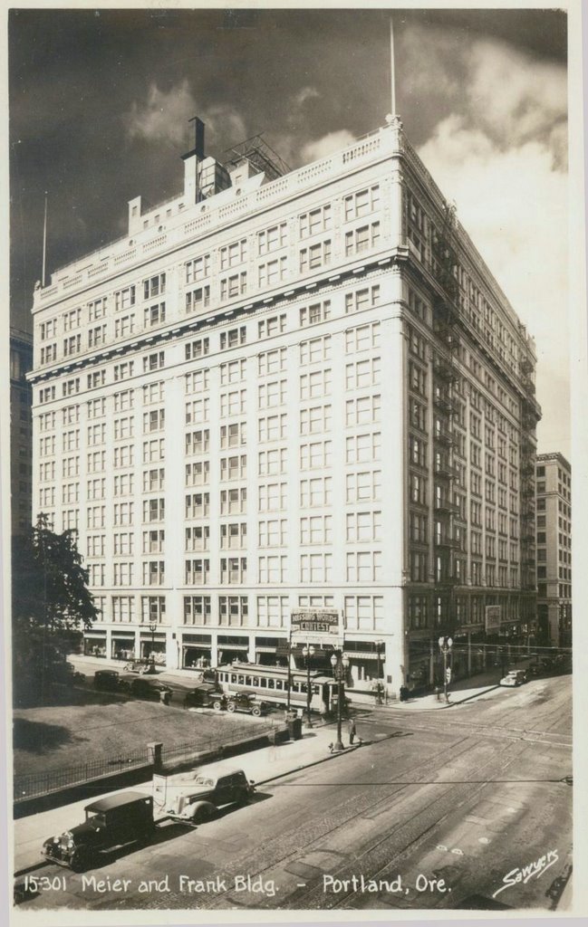
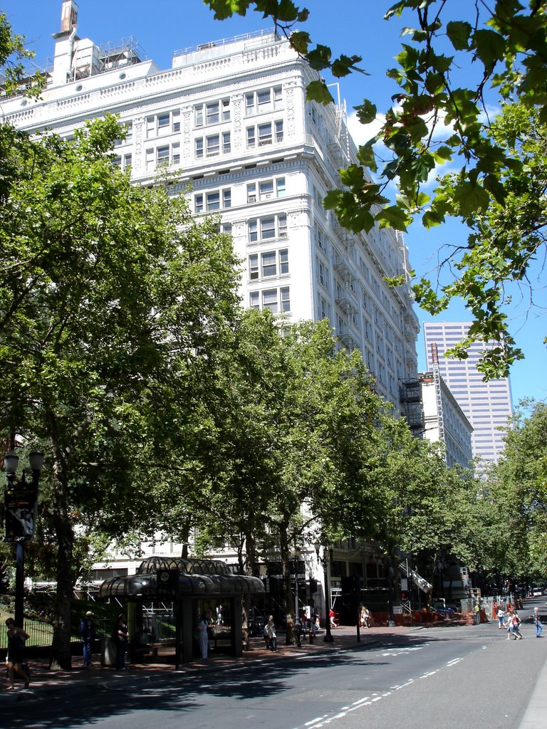
It is one of Portland’s iconic locations. Aaron Meier opened his general store on the corner of Front Street and Yamhill in 1857. In 1872 he took on Emil and Sigmund Frank as partners to form Meier & Frank. The store moved to Fifth and Morrison in 1898, taking with it Portland’s retail core. The present terra-cotta sheathed edifice was built in three segments in 1909, 1915 and 1932. When complete, it covered the entire block between 5th and 6th, Morrison and Alder. Today it is a stately reminder of past grandeur, but the white terra-cotta face of the building was chosen for its modern appearance.


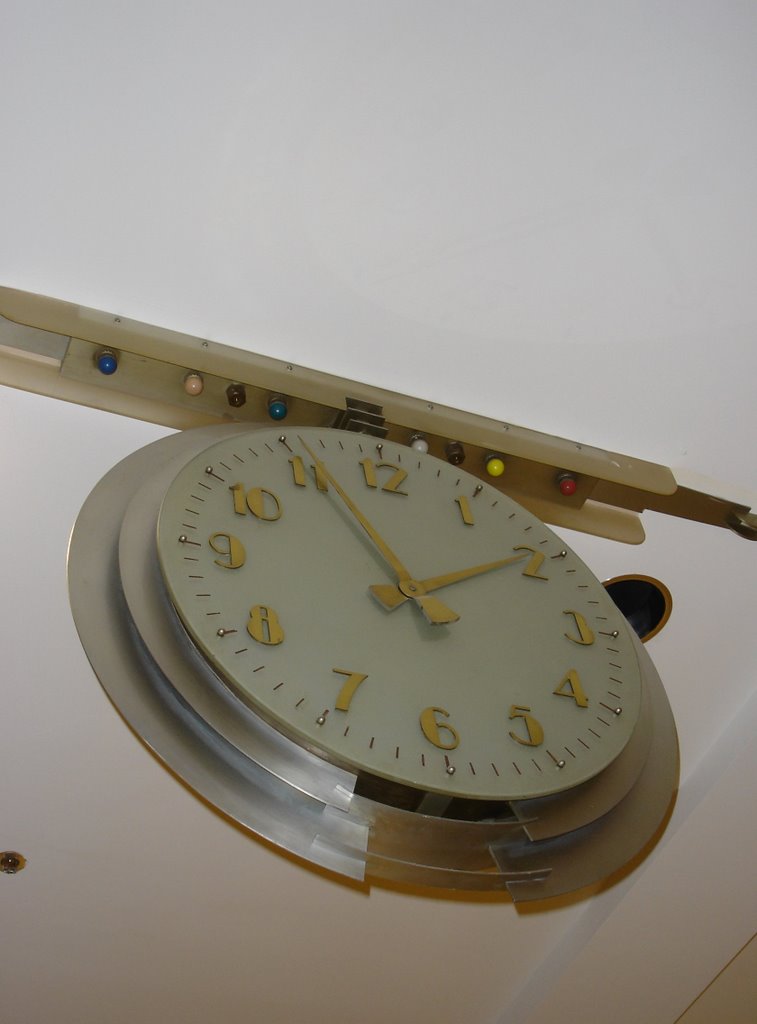
For decades, Meier and Frank stood at the social epicenter of downtown Portland where everything from clothing to books, pharmaceuticals and pets could be purchased. Clark Gable sold ties there in 1922 before going on to bigger and better things. People would rendezvous “under the clock” on the main floor. They would meet for lunch in the Georgian Room. At Christmas they took their children to Santaland (with a monorail!) on the tenth floor. The building's upper levels served as corporate headquarters for a chain of department stores that would eventually expand to include locations in Oregon, Washington and Utah.


Meier and Frank was acquired by May Company in 1966. It was operated as an independent division, headquartered in Portland until 2002. Current operator Macy’s Northwest has dropped the Meier and Frank name rebuilding and re-branding the department store as Macy’s at Meier and Frank Square.


As part of the redevelopment plan, a new luxury hotel and restaurant is slated to be built in the upper floors.

The name of the hotel should imply place, history and style befitting the hotels setting. Under Sage Hospitality’s Luxury Collection brand, the name will likely be along the lines of The _____, A Luxury Collection Hotel.


The most site-specific name, Meier and Frank is too derivative of the buildings history as a department store. The Frank, however has a certain muscular panache. The Pioneer speaks to the hotels proximity to Pioneer Courthouse and Square though perhaps it is a tad rustic. The Georgian honors the storied Meier and Frank restaurant.
After the transit mall is rebuilt, the hotel will have access to the Max light rail system on three sides. Thus, The Max, (spiced with just a hint of Weimar decadence).

Reaching far back, the building sits on a part of William Overton’s original claim, co-owned with Asa Lovejoy on the future site of downtown Portland. The Overton has the stylish sound of a classic hotel. For that matter so does The Lovejoy, (could a place for romantic getaways have a better name?) Portland’s other early proprietors; Pettygrove, Chapman, Stark and especially Coffin are not as well suited, but The Lownsdale has potential.

The name Marquam is usually associated with the area just to the south of downtown where Phillip A. Marquam purchased 390 acres in 1858 (Marquam Hill, Marquam Gulch, the Marquam Bridge). He once however owned the entire block to the west of the Meier & Frank building where he built the Marquam Grand Opera House (later Theater) in the early 1890s. The Marquam or even
The Marquam Grand
is an excellent appellation for a high end hotel and returns a historic name to downtown Portland.

Eight names, vetted for place, history and style, offered pro bono!
-Not that I would refuse a nights lodging and dinner for two at the restaurant if this post helped in the naming of a luxury hotel ...


The building to the immediate right is the first Meier & Frank store at 5th and Morrision. To the far left can be seen the Hotel Portland, torn down by Meier & Frank in 1951 to make way for a parking lot (the site of today's Pioneer Courthouse Square). The tall red brick building to the right is the Marquam Grand Theater nee Opera House. The Portland Symphony (later Oregon Symphony) had its first performance there in 1896.
Then, as now, the Pioneer Courthouse (formerlly Post Office) is across the street from Meier & Frank, the corner of its lawn is in both pictures (as well as the black and white postcard at the begining of this post).


Tuesday, June 20, 2006

An Overlook Overview


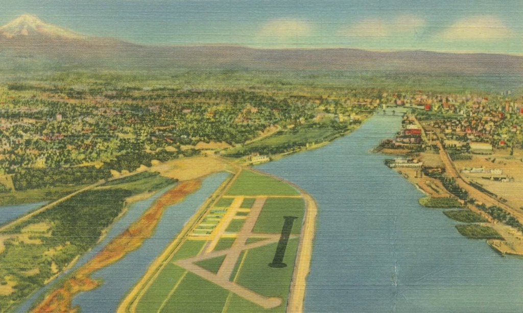
The Overlook Neighborhood area in the 1930's looking south on the Willamette River and the Portland Airport on Swan Island. (Click on pictures to enlarge).

A version of this article appears in the July / August 2006 issue of Overlook Views.

Where is Overlook?

The Overlook Neighborhood is at the far southeast corner of North Portland, the part of Portland on the peninsula between the Willamette & Columbia Rivers.

From another perspective, it can be said that the neighborhood sits on parts of Montana, Idaho, Washington and Oregon as the peninsula is built of debris washed down the Columbia River during the cataclysmic ice age Missoula Floods.


The official boundaries of the Overlook Neighborhood are west of Interstate 5, north of the Fremont Bridge and south of Ainsworth Street. According to the most recent census (2000) the neighborhood had a population of 6,093 people living on 2,121 acres. Overlook has a population density of 2.87 persons per acre.

With so few people per acre, why doesn’t the neighborhood look and feel like a Southwest Portland suburb?

It is because over half of the land within the Overlook Neighborhood Association has no residences at all. Swan Island and the Mock’s Bottom industrial areas as well as the Union Pacific rail yards are all technically within Overlook. When Portland’s neighborhood association boundaries were drawn in the early 1970s, those areas were included due to concerns about Swan Island traffic passing through the neighborhood on the way to Interstate 5.

Without Swan Island and Mock’s Bottom, the neighborhood is half as large and twice as dense.


Circa 1852, "Gently rolling soil, good second rate clay loam. Timber: fir, a little maple, cedar and hemlock..."

Overlook sits on seven of the original Portland area Pioneer Donation Land claims that were awarded to early settlers in the 1840s. North of today’s Killingsworth Street were the claims (from west to east) of Phillip T. Smith, Josiah Atkinson and Evander Howe. South of Killingsworth was Frederick Proebstel’s, George Darch’s and Jonathan Gerow’s claims. Below Going Street was the claim of James Thompson. His farmhouse was located in the area where Longview Avenue meets Overlook Blvd.

Four other Pioneer Donation claims were on the marshy flood-plain beside the river. Lemuel Hendrickson’s claim was Swan Island. An 1852 map described the area on the bluff as having “gently rolling soil, good second rate clay loam. Timber: fir, a little maple, cedar and hemlock.”


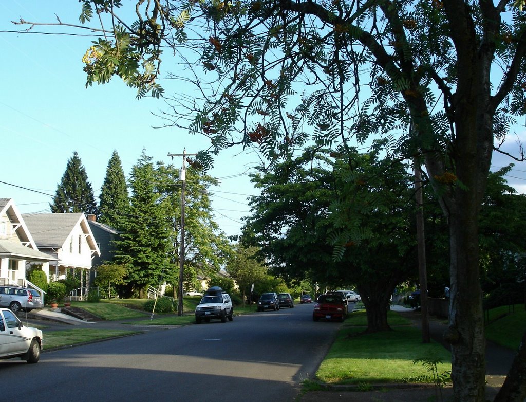
Delaware Avenue between Jessup and Killingsworth. The boundary between the Josiah Atkinson (left, east) and Phillip T. Smith (right, west) pioneer donation land claims runs down the center of the street.

As time passed, the donation claims were divided into smaller lots, farms, pastures and woodlots. Roads appeared on the bluff. In 1890 the Willamette Bridge Railway built a steam powered passenger railroad through the area. It followed the future alignment of Killingsowrth to Greeley, then on to Lombard and west to St. Johns, (then an independent city). Eventually the line was electrified and incorporated into the streetcar system.


The Willamette Bridge Railway's #5 on the steam line on the bluff between Albina and St. Johns in 1890. The photo is from the new book "Portland's Streetcars" by Richard Thompson and is provided courtesy of the author. The book is availiable at Powells Books.


Mio Sushi, Sal's Famous Italian Kitchen, the Sagittarius Bar and Grill and the SohBet Coffee House on the corner of Killingsworth and Greeley where the streetcar line turned north on its way to St. Johns. The building on the left was built to accomodate the curve of the tracks.

Before it was a part of Portland, the area was in the city of Albina. In 1891, just before Albina consolidated with Portland and East Portland, it expanded from its core near Russell and Williams streets all the way north to the Columbia River. Although the area was inside city limits, it was still rural in nature with only a few scattered Victorian era farm houses on the bluff.

The Eliot / Sullivan house on Willamette Blvd near Denver Ave in 1912. The house was built in 1902, a fine example of early architecture in the neighborhood. It is currently being restored.

Development came from the south and east. Additions were plated and streets established. New houses were built as Portland’s northern suburbs expanded along streetcar lines. By 1897 much of the area south of Killingsworth had been plated and by 1907 most of the today’s neighborhood’s streets were in place. In many places the houses were still fairly far apart. Even after the housing boom which followed the Lewis & Clark Centennial Exhibition in 1905, the area had some feeling of the countryside. As late as 1915 there were complaints about stray cattle in the neighborhood.


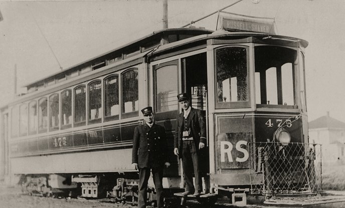
Portland Railway Light & Power car #475 at the end of the Russell-Shaver Line on Shaver between N. Castle and Concord some time before World War I. The house visible in the background is the back of #4048 Castle, a half block away. The neighboring houses in the area were yet to be built. The RS line ran until 1937 when it was replaced by a gasoline bus extension of the 39th Avenue Line. The service was abandoned in 1953.


The "Nameless Park" on the bluff between Prescott Street and Skidmore Court.

Twenty three additions or tracts of various shapes and sizes make up today's Overlook Neighborhood. Most of their names have fallen out of use although Madronna Hill is still associated with the general area along Greeley. The name Overlook comes from the Overlook Addition, the area south of Skidmore and west of Interstate. It was surveyed for development in 1905, after the land had been tied up in a legal dispute for years (which explains the lack of any Victorian era houses in that area). The Cooks, Multnomah, First and Second Patton and North Albina addiditions were all split by the construction of Interstate 5 in the early 1960s. The Nutgrove addition is along the east side of Campbell between Killingsworth and Ainsworth. It is five blocks long but only one lot deep.


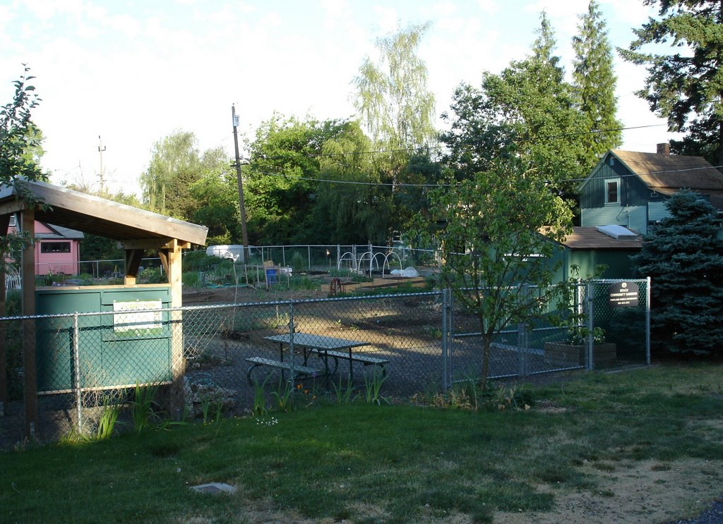
The Beech Community Garden is in the three block long Pittiger's Addition. It is said that some of the houses in the area escaped demolition by being moved there out of the path of I-5 in the early 1960s during the construction of the Minnesota Freeway.


Longview Avenue, is four blocks long and is entirely in the Overlook Addition. Plated in 1905, the street predates Longview Washington by 18 years.


In 1916 Interstate Avenue was created as part of Pacific Highway #1 by combining the north end of Patton Avenue and the south end of Maryland Avenue. The remaining portion of Patton south of Prescott was renamed Massachusetts Avenue. New segments were graded down the bluff to Albina and north to the new Interstate Bridge. The first auto shops and billboards followed soon after.


Interstate Avenue from Skidmore circa 1930-1931, looking toward the present location of the Archiform Building and Fire on the Mountain Wings.
Oregon Historical Society photograph, used with permission.


Many sights of the neighborhood in the 1930s would be recognizable to today’s residences. A housing boom in the twenties had filled the majority of the vacant lots in the area. Killingsworth, Interstate and Mississippi were the main commercial streets. Interstate Avenue was part of Highway #99 and was lined with motels and service stations. Beech Elementary school was open for the neighborhood’s children. Overlook Park had just been created on land that had been used as a dump. St Stanislaus Church had Sunday services. The Interstate Firehouse was in use -as a firehouse.

The Interstate Firehouse Cultural Center next to Patton Park.

As early as 1903, John Olmsted in his plan for Portland parks proposed "Multnomah Park" at the future location of Overlook Park. For many years the site was used as a dump. Robin explores the picnic building at Overlook Park, built in the 1930s.

The sounds of the neighborhood were different though. The constant shriek and moan of whistles from steam locomotives, boats and ships came up the bluff from below. Douglas DC-3s and Lockheed L-10 Electras droaned as they circled above the new Portland Airport on Swan Island. The rumble and clatter of streetcars could be heard on Killingsworth, Greeley and Shaver. The gong of service bells rang from the many gas stations on Interstate Avenue.


Interstate Automotive is inside of the last surviving 1930's era gas station on Interstate Avenue.


The 76 station at N. Killingsworth and Interstate is one of the busiest service stations in the city.

Things got louder in World War II.

The Kaiser Swan Island shipyard was built on the site of the Airport which had outgrown its location. Around the clock, workers constructed T-2 tankers for the war effort. At night work continued beneath the bluff under massive light towers that cast a glow visible for miles.


Tanker Champs- The Swan Island shipyard.


The USS Ochocco was a T2 tanker built at Swan Island in 1943. She is shown here after the war as the Esso Normandy. She was scrapped in 1961.


Many houses in the neighborhood took boarders to alleviate the housing shortage brought on by the influx of wartime workers. On Interstate Avenue, workers and residents rode a new trolley bus line to work and home.
Years later, in 1959, Bess Kaiser Hospital was built on the bluff over the former site of the Kaiser Swan Island shipyard.


A trolley bus (trolley coach) operated by the Portland Traction Company on the Interstate Line. Clean , very fuel effecient (!) and quiet, the trolley coaches operated in Portland from 1937 until 1958. They still do in Vancouver BC, Seattle and San Francisco. No one knows why they do not in Portland. A cynic might think that General Motors had something to do with it.


The sign at the Palms Motel, a surviving example of 1940's Highway #99 architecture.


The biggest single change the neighborhood ever faced was also its most detrimental. On March 23, 1960 the Portland City Planning Committee approved the alignment on the Minnesota Freeway, the route of Interstate 5 through North Portland. By the time I-5 was completed 1963, hundreds of homes were displaced. Some houses were moved but most were torn down. A resident of the time recalls neighbors rescuing plants from deserted yards after the houses were demolished.

A swath was cut through North Portland sundering long established connections. Many businesses closed on both sides of the divide. A report by the Portland Planning Bureau from 1964 stated: “Completion of the Minnesota Freeway has had a telling effect on traffic counts in the district. Interstate Avenue has experienced a drastic reduction in traffic volumes.”

The decline of Intestate had negative effects on the surrounding neighborhood. Concerns about crime, safety, vandalism and traffic from Swan Island were some of the issues that lead to the formation of the Overlook Neighborhood Association in the early 1970s.


The segement of I-5 through North Portland is also known as the Minnesota Freeway. The picture above is from the Failing Street pedestrian overpass at the former location of Minnesota and Failing streets. The same location is shown on a Sanborn Insurance map from 1950. Note the chuch in the map at the corner of Shaver and Missouri is to the right in the picture.

Today the neighborhood is in the midst of a vital upswing as the value of a close-in and close-knit community becomes apparent. There is a farmers market at Overlook Park. Restaurants have returned to Killingsworth and grocery stores to Interstate. Along the former route of the trolley bus of the 1940's and 1950s development is following the two year old Interstate Max line. Nearby Mississippi Avenue is exploding with activity. Kaiser Permanente re-affirmed its long standing ties to the area by expanding its Interstate campus. adidas renovated the Bess Kaiser hospital for use as its corporate headquarters; adidas Village. The Interstate Fire House Cultural Center, St Stanislaus Church, Overlook House and Kaiser Town Hall are all community gathering places.

It is a great time to live in Overlook.


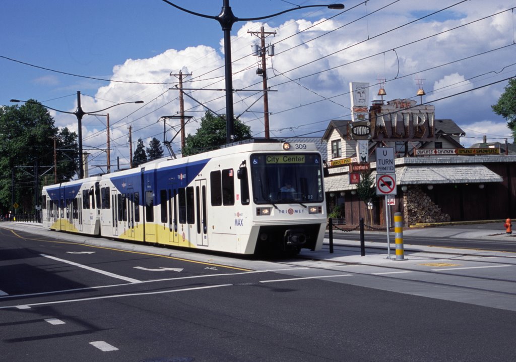
The Interstate Max line passes The Alibi at N. Shaver and Interstate Ave in 2004. The Alibi is said to be on the site of the Chat-n-Nibble, an establishment dating from the late 1890's. Later, the location was a tavern called Max Alibi. In 1947 it was renamed The Alibi. It is a holy place of Tiki Nation. The Russell-Shaver streetcar line crossed Interstate Avenue at this point until 1937.


addidas renovated and expanded the former Bess Kaiser hospital to make addidas Village.


Underlook: The Willamette River from Swan Island near the Freightliner offices. In 1806, a party lead by William Clark came up the "Multnomah River" to a point near this location while the rest of the Lewis & Clark expedition was camped on the Columbia.


Thanks to:
Dick Thompson, Roy Bonn, Alan Eisenberg , Mike Parker, Kenn Lantz, Mark Moore and Art Griesser for images and / or expertise regarding Portland streetcars and trolley coaches.
http://www.t2tanker.org/ for information on the Swan Island built T2 Tankers.
Warren Cassell for editing Overlook Views and setting a deadline.

The Oregon Historical Society.